


With more than 20 years of experience in providing navigation and positioning services on floating vehicles such as drilling rigs, barges, crane ships, cable-laying vessels, pipe strips, service ships operating near shore or offshore… serving geological surveys, construction works, moving and positioning drilling rigs, surveying, pipe laying, underground cable instalation, anchoring, positioning for diving, installation and location monitoring. At sea, the Center for Sea Survey and Mapping (Seamap) has continuously invested in equipment, researched technology, applied solutions to improve quality, increase stability and accuracy. precision to the highest level to meet all requirements even the most stringent of all domestic and foreign customers.
Seamap’s navigation and positioning system installed
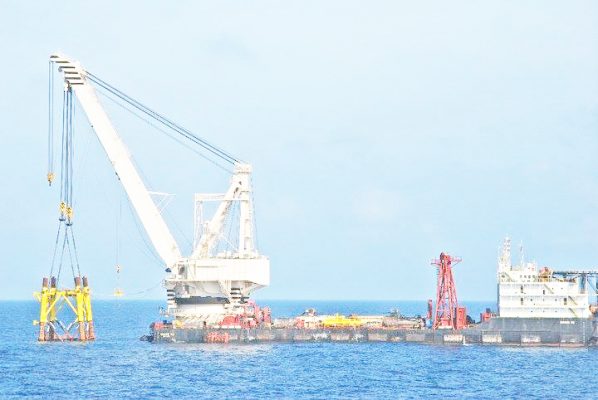
on the crane ship Hoang Sa -Vietsovpetro to serve the installation of the jacket
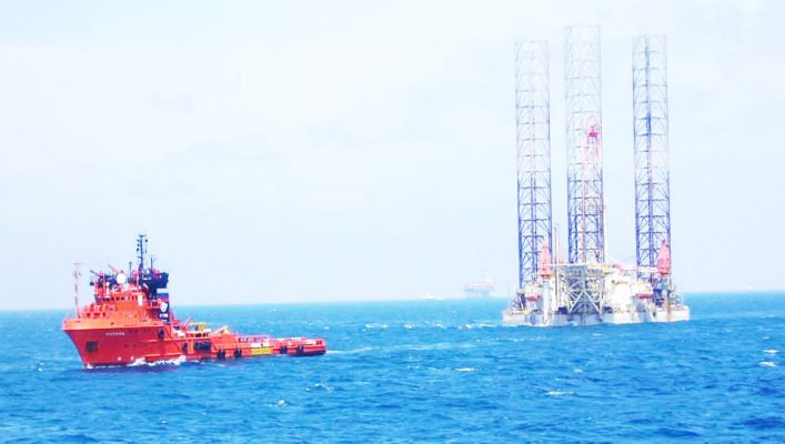
Seamap’s navigation and positioning system is installed
on the rig for rig positioning
Seamap currently manages, operates and exploits the national positioning station system including the DGPS Reference Stations with MSK-DGPS technology built along the coast of Vietnam for survey, positioning and navigation at sea. The basic feature of this technology is that it allows the transmission and reception of DGPS correction signals in a wide range with a radius of up to 700km at sea and about 400km on land with positioning accuracy to meters. This is a Multi-function system for surveying, navigating, collecting dynamic differential data. In addition to the above signal, Seamap also uses commercial DGPS correction signal sources with extremely high stability and positioning accuracy ranging from 1 decimeter (dm) to several centimeters. (cm). With the G2+ correction package, the accuracy reaches to centimeters (3cm for position and 8cm for elevation)

Example image of GNSS navigational satellite
2.Improvement of high-precision marine navigation positioning technology Positioning technology has become popular in the world and applied to many fields in real life. However, to achieve high accuracy and stability offshore, or hidden places that interfere with GPS signals due to construction, requires a big investment in equipment, software as well as technology. With the requirement of real-time dynamic positioning in the open sea with high accuracy in both coordinates and altitude, in addition to correcting errors in time, satellite orbit, errors due to the influence of the troposphere and ionosphere in the earth’s atmosphere, multipath interference… We also use advanced technologies in solving the cause of ambiguity between satellite and receiver (IAR) in Phase measurement, precise point positioning technology (PPP), integrated GNSS navigation system (GPS, GLONASS, BeiDou and Galileo) to achieve: -Offshore real-time dynamic positioning accuracy reaches cm accuracy;-Extremely high signal stability thanks to the GNSS system;-The backup system is fully redundant during job execution.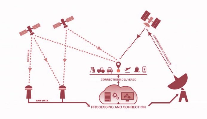
Diagram of the process of processing and providing DGPS
correction signals – illustration picture from the internet
Many domestic and foreign customers have experienced and used our services and highly appreciated the service quality and work capacity.
.