-
Seamap’s single- and multi-beam echo sounding technology and seabed topographic mapping technology keep pace with the development of world technology
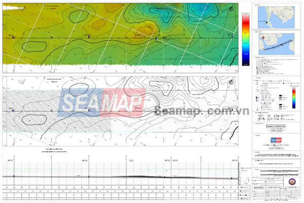 Seabed topographic map
.

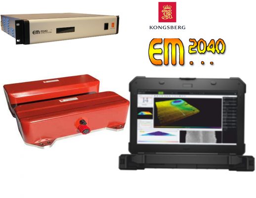 Kongsberg 2040 MKII Multibeam Sytem
2. Application of multi-beam depth measurement technology in addition to creating topographic maps
Trong những năm gần đây nhờ sự phát triển cao về công nghệ đo sâu đa tia, cho phép các kỹ sư thủy đạc có thể khảo sát với độ chính xác rất cao ở vùng nước nông mà không cần sử dụng thêm hệ thống quét sườn (SSS).
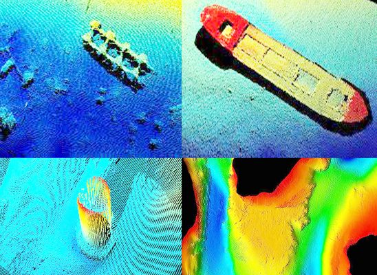
Một số hình ảnh dữ liệu thu thập từ hệ thồng đo sâu
đa tia EM2040 MKII
3. Single-beam and multi-beam echo sounding technology creates trust and conquers domestic and foreign customers.
With the existing leading capacity in Vietnam in surveying the topography of the seabed, riverbed, lake… with single and multi-beam echo sounding technology, Seamap has been trusted by many domestic and foreign customers to sign contracts. Jointly carry out survey of installation, maintenance and repair of works at sea, installation of underground power cables to islands, typical works: seabed survey – pre-construction including USBL positioning, surveying scanning the Sonar side and surveying the terrain with a multi-beam depth gauge of the underground electric cable to Ly Son island, Quang Ngai province for PMS customers; survey at Cai Lan port, Quang Ninh province by single-beam and multi-beam technology for HALLA ENGINEERING-Korea; Maritime survey on cable route design for the Project: Power transmission for 110kV high voltage underground cable to Co To island, Quang Ninh province; Marine survey for the 110 kV high voltage underground cable connecting the mainland between Ha Tien and Phu Quoc island for Prysmian Powerlink Srl-Italia; Seabed geological survey, topographic survey, route survey for construction drawing design, construction estimate, equipment supply & technology and construction of undersea cable for Thanh An island commune – Can Gio district – Project: Construction of 22kV submarine cable line across the sea to supply electricity to Thanh An commune – Can Gio district; Survey and construction of 110kV underground cable strip bringing electricity to Cu Lao Cham island, Quang Nam province for customers of Thai Duong power company; Pre-installation survey by single- and multi-beam echo sounding technology in oil and gas exploration and production areas off Myanmar and Thai waters, etc. In addition, Seamap is also gradually making efforts to do a good job of “digital” transformation in management such as building a digital map database, promoting the application of automatic control technology to production activities to improve the quality of products and services. improve competitiveness, increase operational efficiency. This is an important foundation to be able to apply the achievements of the industrial revolution 4.0 and then the industrial revolution.
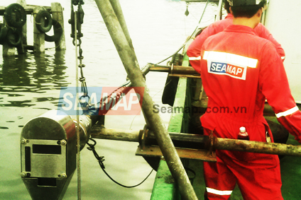
Pictures of the project bringing electricity to Phu Quoc island – Kien Giang