The customer’s requirements are:
– Surveying to check the status of the exposed electrical cable on the sea surface with an accuracy of up to 1.5cm.
– Checking the integrity of submarine cables and cable protectors.
– Making the 3D model of the submarine cables, the the seabed surface of the survey area.
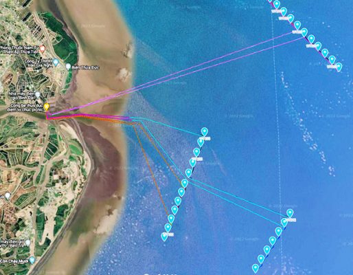
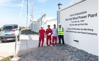
Figure 1: Survey area – Binh Dai Wind Power Plant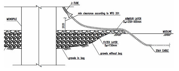
Figure 2: Diagram of electrical cables to be surveyed at wind power poles
Weather conditions at Cua Dai sea, Ben Tre province in May and June are quite complicated, often with thunderstorms and strong winds in the afternoon. The tidal regime in this area is semi-diurnal, tidal amplitude is more than 3m, the current is usually very strong when the tide is up and down. The survey area has a depth of only 1m-6m with the seabed terrain with many sand dunes, so the survey ship is easy to run aground even at high tide. Because it located right at the mouth of a large river, with a lot of silt, the water is muddy all year round, which greatly affects the equipment using sound wave, causing a deterioration in the quality of the survey.
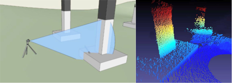
With the above weather, environmental, seabed terrain and hydrology, conventional survey methods using ROV, divers, Multibeam Echo Sounder, Side scan sonar, 2D sector scan sonar … are not met requirements by the client. Therefore, we used a new technology, which is not yet popular in Vietnam, which is 3D scanning sonar.
This method uses a high-precision mechanical 3D sonar scanner fixed to a tripod or a sturdy stand. During the survey, at each measuring station, it creates a thin sweeping strip on the surface of the object to be scanned to collect a set of 3D poinst cloud, combining many stations together will get a complete 3D points clou of the objects to be surveyed. This is a new and advanced method to inspect and survey underwater structures.