


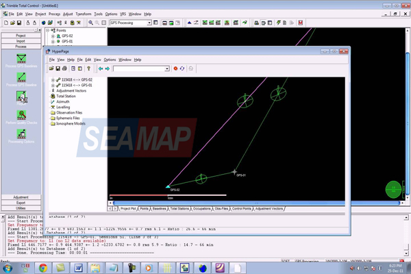
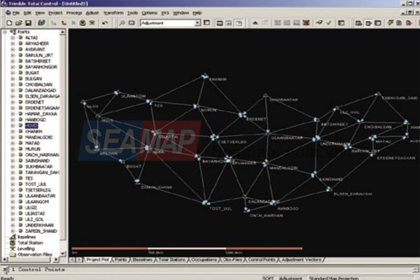
Trimble Total Control software is a powerful, easyto-use survey processing package for GPS and total station data. The software provides advanced geodetic control and GPS processing and analysis tools, making it useful for surveyors who do a lot of control or photogrammetry work, as well as the research, education, and scientific communities.
POWERFUL FEATURES MAKE SHORT WORK OF ANY PROJECT
Trimble Total Control software provides an intuitive and fast solution for survey and geodetic data analysis. This includes:
• Automatic internet download of GPS and control data
• GPS baseline processing
• Support of the Russian GLONASS satellite system
• Data processing for static, fast static, kinematic and continuous surveys
• Support of other GPS manufacturers’ raw data
• Support of conventional total station and digital level data
• Geodetic network adjustment in one, two, and three dimensions
• Geodetic transformations including residual error distribution
• Geodetic datum and projection support
• Advanced GPS and GLONASS data analysis
• Virtual Reference Station (VRSTM) postprocessing
• Continuous deformation analysis
• Manual and automatic quality analysis
• Flexible project reporting