Skip to content
Trung tâm Trắc địa và Bản đồ Biển – SEAMAPTrung tâm Trắc địa và Bản đồ Biển – SEAMAP
  • |
  • HOME
  • INTRODUCTION
    • GENERAL INTRODUCTION
    • FOUNDATION HISTORY
    • ORGANIZATION CHART
    • FUNCTIONS AND TASKS
    • AFFILIATES
  • SERVICES
    • TYPICAL PROJECTS
    • EQUIPMENT
    • SOFTWARE
    • SERVICES
  • NEWS
  • PICTURE STORE
  • CONTACT
  • Seamap Webmail
  • 9
Nhiệm vụ chuyên môn – năm 2018

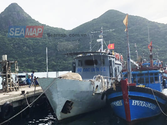
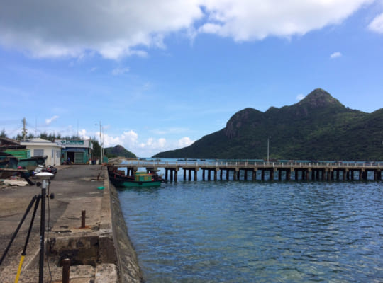
Năm 2018 là năm thứ hai SEAMAP – Trung tâm trắc địa và bản đồ biển

11
Th12
Dịch vụ thiết lập hành lang bảo vệ bờ biển

Ngay sau khi Luật tài nguyên, môi trường biển và hải đảo năm 2015 và

02
Th12
Sản phẩm bản đồ biển Việt Nam 1:50000; 1:10000; 1:5000

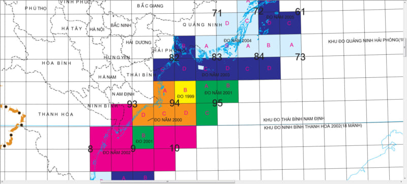
Bên cạnh các sản phẩm dịch vụ, các sản phẩm điển hình Seamap với tiêu

05
Th11
Khảo sát Cửa sông Thu Bồn – Cửa Đại – Hội An

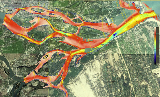
Đây là dự án khỏa sát phục vụ đánh giá ảnh hưởng của lũ đối

04
Th10
Danh mục
  • Decisions (6)
  • Equipment (32)
    • Hydrographic Equipment (20)
    • Other Equipment (8)
    • Positioning Equipment (9)
  • Independent Units (4)
  • Introduction (7)
  • Labratory (1)
    • Documents (1)
  • Legal Documents (6)
  • News (35)
    • Activities (2)
    • Activity News (8)
    • Events (7)
    • Hot News (22)
    • Projects (1)
    • Technology (1)
  • Seamap (6)
  • Services (6)
  • Software (7)
  • Typical Projects (14)
    • Site Survey (7)
    • Thành lập Bản đồ (4)
    • Typical Projects (2)
    • USBL underwater positioning (1)
VIDEO TIÊU BIỂU
https://youtu.be/R68s6v7OIMA
VIDEO TIÊU BIỂU
https://youtu.be/R68s6v7OIMA
CÁC CHUYÊN MỤC
  • Decisions (6)
  • Equipment (32)
    • Hydrographic Equipment (20)
    • Other Equipment (8)
    • Positioning Equipment (9)
  • Independent Units (4)
  • Introduction (7)
  • Labratory (1)
    • Documents (1)
  • Legal Documents (6)
  • News (35)
    • Activities (2)
    • Activity News (8)
    • Events (7)
    • Hot News (22)
    • Projects (1)
    • Technology (1)
  • Seamap (6)
  • Services (6)
  • Software (7)
  • Typical Projects (14)
    • Site Survey (7)
    • Thành lập Bản đồ (4)
    • Typical Projects (2)
    • USBL underwater positioning (1)
CÁC BÀI VIẾT MỚI NHẤT
  • 30
    Th12
    SEAMAP has completed the Side Scanning project at the coastal area of An Giang province (formerly Kien Giang province).
  • 23
    Th6
    FIG WORKING WEEK 2023: PROTECTING OUR WORLD, CONQUERING NEW FIELDS Chức năng bình luận bị tắt ở FIG WORKING WEEK 2023: PROTECTING OUR WORLD, CONQUERING NEW FIELDS
  • 12
    Th7
    Application of “3D scanning sonar” new technology to submarine survey Chức năng bình luận bị tắt ở Application of “3D scanning sonar” new technology to submarine survey
  • 28
    Th3
    Seamap invests and develops technology and equipment for cartography in the new era Chức năng bình luận bị tắt ở Seamap invests and develops technology and equipment for cartography in the new era
  • 11
    Th11
    Offshore positioning services reach a new high level Chức năng bình luận bị tắt ở Offshore positioning services reach a new high level
  • 28
    Th10
    Seamap strives to complete the island investigation mission in 2021 Chức năng bình luận bị tắt ở Seamap strives to complete the island investigation mission in 2021
ĐỐI TÁC - KHÁCH HÀNG
MỘT SỐ HÌNH ẢNH
  • Robot2english
    YOUR COMPANION AT SEA
  • PROVISION OF OFFSHORE SEA SURVEY
  • FOR BATHEMETRY SURVEY
    YOUR COMPANION AT SEA
  • SEABED TOPOGRAPHIC SURVEY AND MAPPING AT ALL SCALES
    YOUR SASTIFACTION IS YOUR TARGET
  • SURVEY FOR LAYING SUBMARINE POWER CABLES TO ISLANDS
  • YOUR COMPANION AT SEA
    SEA SURVEY BY MODERN TECHNOLIGIES
  • YOUR COMPANION AT SEA
    OFFSHORE POSITIONING AND NAVIGATION
  • USBL UNDERWATER POSITIONING WITH HIGH ACCURACY
  • SUBSEA SURVEY


CENTER FOR SEA SURVEY AND MAPPING
No. 108 Chua Lang Street, Lang ward, Ha Noi city.
TL: (+84) +24 37547194
FAX: (+84) +24 3754736
Website: english.seamap.com.vn

DEPENDENT UNITS:
Northern Sea Survey Division
Add: 79 Nguyen Chi Thanh, Giang Vo, HN

Southern Sea Survey Division
Add:  30 Road No.3, Quarter 24, An Khanh ward, HCMC.

Offshore Engineering Survey Division
Add: 126A Do Luong R., Phuoc Thang ward, HCMC

PUBLIC SURVEY SERVICES PROVISION:
Sea surface positioning and navigation
Underwater USBL positioning
Survey and seabed topographic mapping
Bathymetry, Sub-bottom and seabed image scanning for pre-feasibility study, construction, installation, repair, maintenance of offshore topside and underwater structures
Land survey, sinking monitoring and mapping

Follow me!
Share me!
  • |
  • HOME
  • INTRODUCTION
    • GENERAL INTRODUCTION
    • FOUNDATION HISTORY
    • ORGANIZATION CHART
    • FUNCTIONS AND TASKS
    • AFFILIATES
  • SERVICES
    • TYPICAL PROJECTS
    • EQUIPMENT
    • SOFTWARE
    • SERVICES
  • NEWS
  • PICTURE STORE
  • CONTACT