Skip to content
Trung tâm Trắc địa và Bản đồ Biển – SEAMAPTrung tâm Trắc địa và Bản đồ Biển – SEAMAP
  • |
  • HOME
  • INTRODUCTION
    • GENERAL INTRODUCTION
    • FOUNDATION HISTORY
    • ORGANIZATION CHART
    • FUNCTIONS AND TASKS
    • AFFILIATES
  • SERVICES
    • TYPICAL PROJECTS
    • EQUIPMENT
    • SOFTWARE
    • SERVICES
  • NEWS
  • PICTURE STORE
  • CONTACT
  • Seamap Webmail
  • 9
SONARWIZ software

21
Th6
SubSea Gyro/ Motion Sensor – iXBlue OCtans 3000 and TSS series

11
Th10
VESSEL – DO DAC BIEN 01 Survey vessel

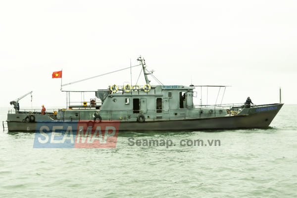
  The DoDacBien01 is a multipurpose survey vessel own by Vietnam Ministry of Natural  Resources

10
Th10
Leveling – Sokkia B20, B40, B Series

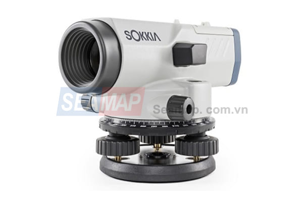
Sokkia B series automatic levels feature enhanced reliability under all environmental conditions. Tough and compact bodies

09
Th10
Motion Sensor – TSS DMS 05,0-25; Kongsberg MRU series

09
Th10
Total Station – Trimble M1, Topcon Series

  The Trimble® M1 Total Station is a versatile, easy to use, conventional surveying instrument that

09
Th10
Radio Link – Trimble HPB 450, TDL 450H Telemetry


09
Th10
Sound Velocity – Valeport Midas SVX+, Mini SVP, SVS

06
Th10
Tide Recorder – Valeport WLR, TideMaster


05
Th10
Trimble RTK R7, R4, R8s

      The Trimble GNSS receiver gives you just the features and benefits you
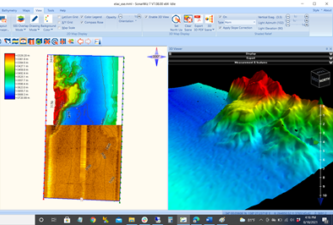
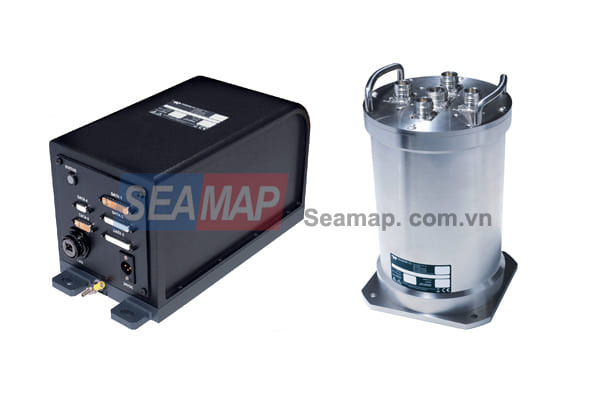
05
Th10
  • 1
  • 2
  • 3
  • 4
Danh mục
  • Decisions (6)
  • Equipment (32)
    • Hydrographic Equipment (20)
    • Other Equipment (8)
    • Positioning Equipment (9)
  • Independent Units (4)
  • Introduction (7)
  • Labratory (1)
    • Documents (1)
  • Legal Documents (6)
  • News (34)
    • Activities (2)
    • Activity News (8)
    • Events (7)
    • Hot News (21)
    • Projects (1)
    • Technology (1)
  • Seamap (6)
  • Services (6)
  • Software (7)
  • Typical Projects (14)
    • Site Survey (7)
    • Thành lập Bản đồ (4)
    • Typical Projects (2)
    • USBL underwater positioning (1)
VIDEO TIÊU BIỂU
https://youtu.be/R68s6v7OIMA


CENTER FOR SEA SURVEY AND MAPPING
28 Pham Van Dong R., Dich Vong Hau ward, Cau Giay Dist., Hà Nội.
TL: (+84) +24 37547194
FAX: (+84) +24 37547365
Email: contact@seamap.com.vn
Website: english.seamap.com.vn

DEPENDENT UNITS:
Northern Sea Survey Division
Add: 79 Nguyen Chi Thanh, Dong Đa, HN

Southern Sea Survey Division
Add:  30 Road No. 3, Quarter 4, An Khanh ward, Thu Duc city, HCMC

Survey and Mapping Services Division
Add: 126A Do Luong R., ward 11, Vungtau city

PUBLIC SURVEY SERVICES PROVISION:
Sea surface positioning and navigation
Underwater USBL positioning
Survey and seabed topographic mapping
Bathymetry, Sub-bottom and seabed image scanning for pre-feasibility study, construction, installation, repair, maintenance of offshore topside and underwater structures
Land survey, sinking monitoring and mapping

Follow me!
Share me!
  • |
  • HOME
  • INTRODUCTION
    • GENERAL INTRODUCTION
    • FOUNDATION HISTORY
    • ORGANIZATION CHART
    • FUNCTIONS AND TASKS
    • AFFILIATES
  • SERVICES
    • TYPICAL PROJECTS
    • EQUIPMENT
    • SOFTWARE
    • SERVICES
  • NEWS
  • PICTURE STORE
  • CONTACT