Skip to content
Trung tâm Trắc địa và Bản đồ Biển – SEAMAPTrung tâm Trắc địa và Bản đồ Biển – SEAMAP
  • |
  • HOME
  • INTRODUCTION
    • GENERAL INTRODUCTION
    • FOUNDATION HISTORY
    • ORGANIZATION CHART
    • FUNCTIONS AND TASKS
    • AFFILIATES
  • SERVICES
    • TYPICAL PROJECTS
    • EQUIPMENT
    • SOFTWARE
    • SERVICES
  • NEWS
  • PICTURE STORE
  • CONTACT
  • Seamap Webmail
  • 9
COMPASS – TSS MERIDIAN Gyro Compass – Survey version

05
Th10
FUGRO Starfix HP, DGPS, G2 Receivers

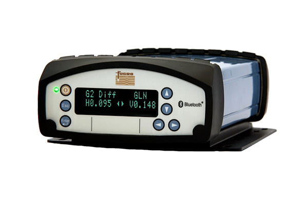
Fugro’s Starfix products and services provide vessels and rigs around the world with precise offshore positioning

05
Th10
Trimble SPS x61 Series – DGPS and Heading System

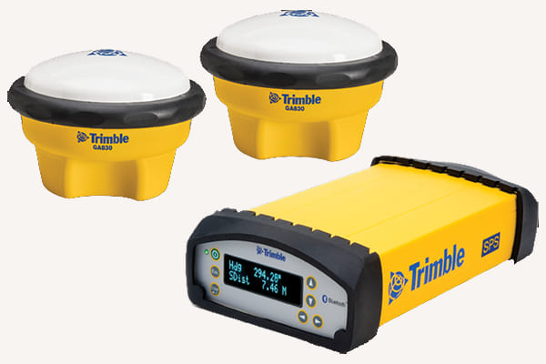
  Trimble SPSx61 Modular GPS Heading receivers are ideal for the following site development and

05
Th10
TRIMBLE DGPS Positioning System

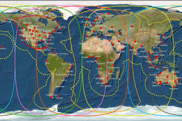
  Trimble Positioning Services is an enabling technology provider with global reach offering solutions for

05
Th10
FUGRO Starfix Positioning System

  Starfix® delivers precise high performance positioning services for offshore construction vessels, survey operations, pipelay and

05
Th10
SSS – Edgtech 4200 Side Scan Sonar – Multi-Purpose Survey System

05
Th10
SSS – CMAX CM2 Side Scan Sonar

04
Th10
ODOM HYDROTRAC/ECHOTRAC MKIII (Dual frequency) Single Beam echo Sounder Series

04
Th10
MBES – R2SONIC Series Multibeam Echo Sounder

04
Th10
MBES – Kongsberg EM710 Multibeam Echo Sounder

04
Th10
  • 1
  • 2
  • 3
  • 4
Danh mục
  • Decisions (6)
  • Equipment (32)
    • Hydrographic Equipment (20)
    • Other Equipment (8)
    • Positioning Equipment (9)
  • Independent Units (4)
  • Introduction (7)
  • Labratory (1)
    • Documents (1)
  • Legal Documents (6)
  • News (34)
    • Activities (2)
    • Activity News (8)
    • Events (7)
    • Hot News (21)
    • Projects (1)
    • Technology (1)
  • Seamap (6)
  • Services (6)
  • Software (7)
  • Typical Projects (14)
    • Site Survey (7)
    • Thành lập Bản đồ (4)
    • Typical Projects (2)
    • USBL underwater positioning (1)
VIDEO TIÊU BIỂU
https://youtu.be/R68s6v7OIMA


CENTER FOR SEA SURVEY AND MAPPING
28 Pham Van Dong R., Dich Vong Hau ward, Cau Giay Dist., Hà Nội.
TL: (+84) +24 37547194
FAX: (+84) +24 37547365
Email: contact@seamap.com.vn
Website: english.seamap.com.vn

DEPENDENT UNITS:
Northern Sea Survey Division
Add: 79 Nguyen Chi Thanh, Dong Đa, HN

Southern Sea Survey Division
Add:  30 Road No. 3, Quarter 4, An Khanh ward, Thu Duc city, HCMC

Survey and Mapping Services Division
Add: 126A Do Luong R., ward 11, Vungtau city

PUBLIC SURVEY SERVICES PROVISION:
Sea surface positioning and navigation
Underwater USBL positioning
Survey and seabed topographic mapping
Bathymetry, Sub-bottom and seabed image scanning for pre-feasibility study, construction, installation, repair, maintenance of offshore topside and underwater structures
Land survey, sinking monitoring and mapping

Follow me!
Share me!
  • |
  • HOME
  • INTRODUCTION
    • GENERAL INTRODUCTION
    • FOUNDATION HISTORY
    • ORGANIZATION CHART
    • FUNCTIONS AND TASKS
    • AFFILIATES
  • SERVICES
    • TYPICAL PROJECTS
    • EQUIPMENT
    • SOFTWARE
    • SERVICES
  • NEWS
  • PICTURE STORE
  • CONTACT